Taste of Tassie (Part 1)
- jmsrtldg
- Mar 22, 2025
- 18 min read
Updated: Apr 3, 2025

The trip from Raymond Island to Geelong North and the Spirit of Tasmania (SoT) went without incident, although it has to be said (again) that the traffic through Melbourne was a horribly slow and very frustrating affair!

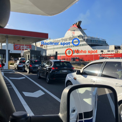

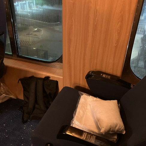
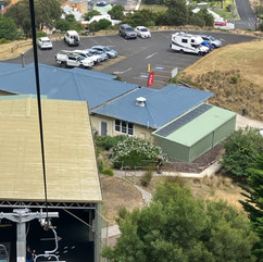
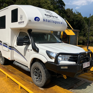
Preparing to board the SoT My recliner spot for the night crossing (plenty of leg room!)
The SoT terminal opened its gates at @1900. It took only 15 mins to obtain my boarding pass, conduct border security checks (they are very strict about not bringing fresh produce into TAS), and be marshalled into one of @ 8 lanes undercover (sorted by length and height). All this was achieved with great efficiency, however, there was subsequently nothing to do until @ 2115, when boarding activity recommenced onto SoT in earnest. Once again the marshalling was very efficient, and I was embarked/parked up by 2140. The 2200 ETD turned into 2300 and I eventually retired to my window-side recliner with blanket and pillow following a very late pie and beer for my dinner. While the crossing was comparatively calm, I suffered a bout of vicious shingles which precluded getting much sleep, eventually dozing off around 0600....to then be woken up at 0700! Breakfast and coffee was followed by a delayed ETA into Devonport, Tasmania, at @0930. While I had booked into a caravan park nearby for a couple of days, I can report that there was very little activity in Devonport on this particular weekend!

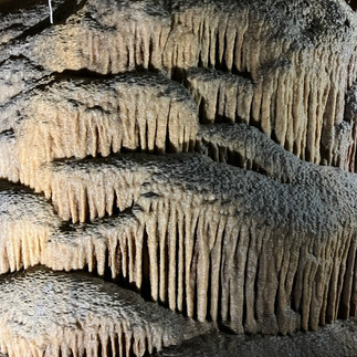

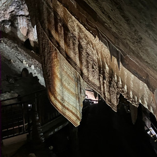


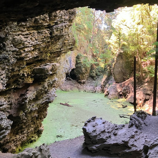
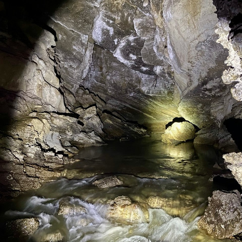
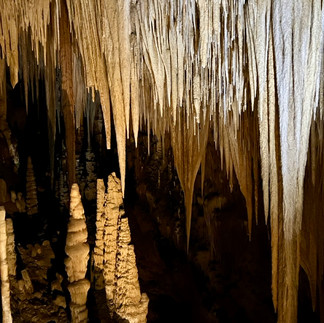
Gunn Plains Cave - Wedding Cake Gunn Plains Cave - sheet stalactites Silver Falls, waterfall circuit
My first foray was to take a guided tour of the caves at Gunns Plains, which were impressive. As well as the usual stalagmites and stalactites, they also had some of the best examples of sheet stalactites (centre image above) which reminded me of a giant rasher of bacon! I camped overnight on the property of a kind Explorer Motorhome Owner (EMO) (...and slightly alternative lifestyler with the chosen name of "Peregrine Riversong"!). The following day I 'did' the nearby Preston Falls (which were a bit underwhelming because there had not been much rain), followed by the Castra waterfalls "circuit" in the middle of the bush. Unfortunately I managed to stray from the marked track and get comprehensively lost, albeit for a short period of time. Luckily I still had one bar of mobile coverage and was able to climb up to the (sole) road, which ended up being only a couple of hundred metres from where I had parked the moho! Still, a big sigh of relief (and lowering of my heartrate ensued (and I shall endeavour to take my Personal Locator Beacon (PLB) with me in future trips where there are few people around!

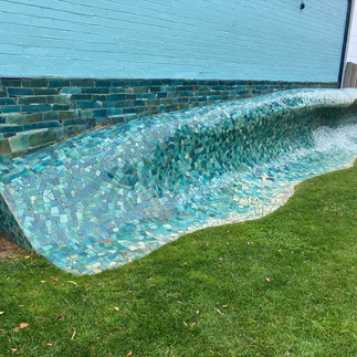

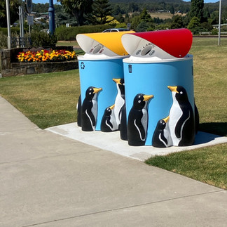

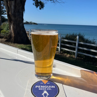
Ulverstone - Wave scultpure Penguin recycling and rubbish bins Local beer from beachside brewery...nice!
I then moved back to the NW coast via Ulverstone to Penguin - a delightful seaside town where I stayed for a couple of nights. The campground was the only one in town and charged accordingly. While the waterfront location could not be faulted, the standard of amenities (with only one washing machine and no dryer) left something to be desired...but dhobes (washing) waits for no man (or woman, no wait, that should be gendered or non-gendered peoples)!

I met another 'EMO' at the campground who recommended the soft serve cherry ice cream from a van selling everything cherries from a carpark near the main highway (the Bass Highway) about 6 km away. Having set up the moho, I jumped on my trusty e-scooter and raced over there only to find that they had sold the last of ice cream to the people in front of me in the queue! I vowed to come back the following day, which I did, and it was definitely worth it (....as I also stopped in on my way westwards the day after that, as well!).
With distances being so much closer by comparison with those in the great Australian outback, I found myself travelling less than 50km before Free Camping in Cooee Point Reserve (just had to stay there with such an iconic Aussie name like Cooee!) for a couple of nights. While the weather was very wet and windy to start with, it did abate eventually. While there, I met an Englishman travelling Eastwards who was able to pass on alot of useful recommendations for free/low-cost camping spots for the direction I was travelling.


selfie at Doctors Rocks Doctors Rocks Rocky Cape Lighthouse Aboriginal cave site
I stopped 'en passant' at Doctors Rocks (exciting to a geologist, no doubt, but not so inspiring to me), checked out Rocky Cape and an underwhelming aboriginal cave nearby, before stopping behind the Rocky Cape Tavern (a low-cost ($10 per night unpowered) campground, but it had the necessary amenities with the bonus of cold draught beer on tap and a reasonable pub feed!


Trig Point at the Nut Pademelon on the perimeter walk Chairlft from the top of the Nut Selfie with Stanley and the Nut
Stanley was a quaint little historical fishing town and a popular tourist destination - particularly the volcanic geological 'plug' feature known as 'the Nut'. Despite the grey and drizzly day, I climbed up the Nut (with the aid of my walking poles) and walked the 2km perimeter track at the top. The vistas were impressive but the grey, hazy weather prevented any meaningful photos. I took the chairlift back down, as the very steep pathway was OK to climb but would have played merry hell my arthritic knee going downhill.
I camped overnight in a beachside low-cost campground right in town. Despite my experience during my travels of the majority of campers exercising a modicum of commonsense and consideration for their neighbours in shared sites/close proximity, I did find myself resorting to a 'verbal altercation' with a moron camped beside me in a caravan with his wife who decided to empty 50L of their 'grey water' (washing-up/shower water, etc) that flooded my site and soaked my outdoor mat in their decidedly smelly water. His response of "...sorry, mate - you don't need to make such a fuss about it" as he drove off (despite there being an appropriate and specific dump point but 40m away) elicited a reply from me that contained, at the very least, the words of "inconsiderate" and "wanker" (and possibly a few others besides!).
I had thought that I would sample the famous Tasmanian seafood while based at Stanley, however, the combination of trendy tourist destination and a public holiday surcharge resulted in a half crayfish with chips and salad costing an exorbitant $90, so I passed.

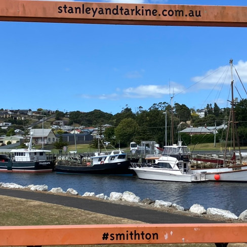


Smithton Tarkine Oysters - yum!
While still not cheap, Smithton a few kms down the road proved a lot less pretentious. I stayed at a free camp at a resort which proved a good spot for a couple of nights. Despite historically not being a huge fan of oysters, I decided to try a platter of local Tarkine Oysters (raw, marinated and cooked)...absolutely delicious...but I fear I have now acquired an expensive taste for the future!


Green Beach, Marrawah Selfie at the 'Edge of the World', Arthur River
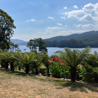
Next stop was another free camp beside Green Beach at Marrawah, the most Westerly point of Tasmania. By getting there around lunchtime, I managed to secure a level sight before the crowds arrived, but it was another great spot with all the basic amenities. I took a long walk along an almost deserted beach that afternoon, but it was just too windy for a swim. Nevertheless, a swim (albeit somewhat 'refreshing') was taken the following morning - before the wind got up again, as was its wont most afternoons. It was a short hop from there to Arthur River and the Edge of the World lookout point the following day (they claim to have the cleanest air in the world here...), but the river cruise was fully booked. I spent the night there in the hope of a cancellation for the next day's cruise, however, it was not to be (and I wasn't prepared to loiter for several days for the next available seat!).


Tarkine Drive - Arthur River Tarkine Drive - Arthur River Tarkine Drive - Lake Chisolm Giant Eucalypt


Tarkine Drive - Sinkhole Tarkine Drive - Trowutta Arch Mount Donaldson Lookout
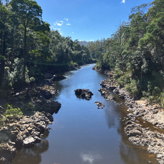
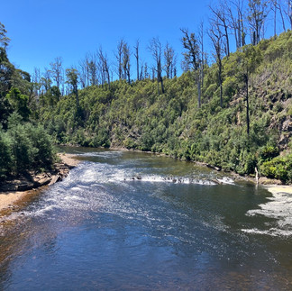
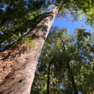
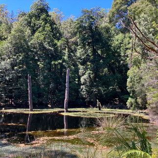
Instead, and following the advice previously received from the staff at the Smithton Information Centre, I set off to tackle the recommended bits of the "Tarkine Drive" - , a wilderness of temperate rainforest, dramatic coastline and river landscapes - lots of lookouts, walks, lakes and sinkholes and giant eucalypt trees. At the end of the day I struck out along the 'Western Explorer' unsealed road towards Corinna. While mostly well-formed, there were some 'gnarly' bits and plenty of corrugations that would have tested 2WD cars (indeed, two of which I passed, both rental vehicles, had experienced punctures. I did stop to offer assistance, but it was declined (thankfully, as it was a very hot afternoon!), but it seemed to me that car rental firms tend to pump up their highway tyres far too much for safe driving on dirt roads in the first place...). I had planned to stop at the first empty free camping spots along the route, but all were taken, so I ended up driving almost the entire Western Explorer route until I was able to find a deserted lookout point high up Mount Donaldson (while not a designated camping spot, there was zero traffic come nightfall, so I took the risk) - spectacular views, but very windy overnight!

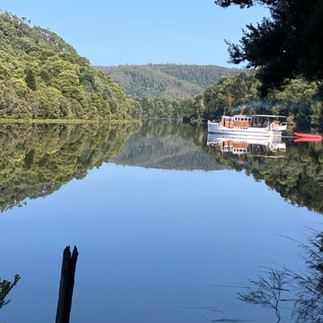


MV Arcadia II on the Pieman River, Corinna Bar at the entrance to the Pieman River Snailspace on the Fatman Barge
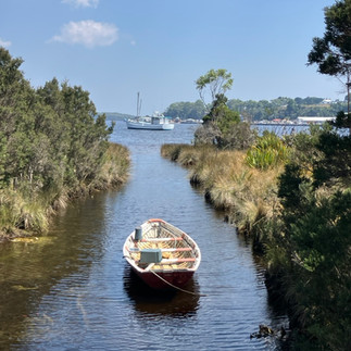
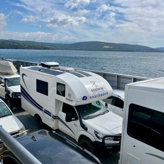
Corinna on banks of the Pieman River was a remote but beautiful spot, but had only one campground associated with the sole business in the area, the Eco Adventure Lodge, so they charged like wounded bulls. I did do a couple of the shorter walks, but both were somewhat but underwhelming (especially a 600m Huon Pine walk described as one of the "5 must-do walks of Tasmania"), but a refreshing swim in the river at the end made up for them both. I camped overnight and enjoyed a very good meal at the lodge. The following morning I spent a lazy 4 hours cruising down the river on the MV Arcadia II (pictured above), built in 1930 out of Huon Pine. I should explain that Huon Pine is a slow-growing conifer (but actually not a pine tree!) that is native/endemic to Tasmania's temperate and wet rainforests in the West and Southwest of the island only. The timber is highly prized for its durable, rot-resistant and high flotation characteristics that make it ideal for boatbuilding. Anyway, the cruise meandered its way down the Pieman River, stopping just short of the rivermouth/bar so the passengers could enjoy a walk on the beach (and an included bag lunch) before returning to Corinna. Following another swim in the river that afternoon, Corinna experienced a couple of brief but dramatic thunderstorms, with much lightning and a little rain. Following this, I then crossed the Pieman River on the "Fatman Barge", stopping at a free camping spot on Lake Pieman beside the Reece Dam overnight. There was already a lot of smoke in the air and a few monsoon-bucket equipped helicopters flying around, with some of the previously-mentioned 'dry' lightning strikes having ignited bushfires throughout the region. While there were bushfire warnings that followed me around for the next couple of weeks, the road to my next destination, Tullah, remained open (the dirt road I had travelled on into Corinna from the North was closed, and the ferry was only taking cars southward).


Tullah Stitt Falls, Roseberry The Spray tunnel, Zeehan
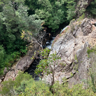
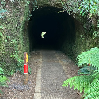
Tullah - I enjoyed a great free camp beside the boat ramp into Lake Rosebery. Unfortunate timing, however, as the Lake had been closed for a several weeks to all recreational activities (including swimming) because an oil spillage into the lake nearby. With no grocery shops since Smithton, I travelled to Rosebery to fuel and provision, returning to a campground in Tullah for a "dhobey run" (naval expression = washing my clothes). The campground also doubled as the sole hotel, bottle store and restaurant for the town (all of which I felt obliged to sample in the interests of promoting local industry, of course). The next day I moved to Rosebery to a free camp recommended by a fellow traveller. The campground was a large open clearing on a bit of a slope just a few hundred metres out of town, but I was able to navigate further down a steep drive to a small and more level clearing beside the river and bridge, which I was to share overnight with a French couple touring in a 4WD with a roof-top tent. While there, I made the short walk to the nearby Stitt Falls, but shouldn't have bothered. Due to the relatively dry summer, not only was there very little flow to get excited about, but the viewing platform was also so badly sited that you were barely able to see the fall of water at all! (as per middle pic above). The golf club at Zeehan was my next overnight stop which had an area adjacent to it for the use of campers for a 'donation' of $10 per night. Unfortunately, the area was also popular with trail bikes and quad bikes, which noisily tore up the surrounds raising clouds of choking dust. Fortunately the prevailing wind meant that I was spared the worst of it, but not all the campers were so lucky. It was also fortuitous that the majority of riders were children whose parents eventually came and picked them and their 'steeds' up at a reasonable hour. I walked up to one of the tourist spots nearby called the Spray Tunnel - a 100m stretch of abandoned rail tunnel carved through a hillside that enabled ore to be transported from the Spray Silver Mine nearby. Its sole redeeming feature of interest was a slightly keyhole-shape to enable the passage of the train's boiler.


Strahan "The Ship That Never Was" Macquarie Heads
I stopped for a couple of nights at Strahan, a small, picturesque port town in the remote West of Tasmania. While its historical claim to fame was as a port servicing both the logging and mining industries of times gone by, it now relies on tourism as its main drawcard. This does translate into expensive accommodation and restaurants, etc, so once again I stayed at the local golf course. Notwithstanding that it was a couple of kms from the campgrounds to the waterfront, my trusty e-scooter had me zipping around town with abandon. On my first night in Strahan I went to see Australia's longest-running play: "The Ship That Never Was" - a comical look at the true story of 10 convict shipwrights who hijacked the last ship built at Tasmania's first convict settlement at nearby Sarah Island as it was about to be relocated to the new prison at Port Arthur. They eventually reached Valparaiso in Chile, where they eventually achieved freedom as the ship had never been formally registered (and, therefore, did not legally exist as a ship - merely a collection of assorted timbers and sundry chandlery items!). It had only two main actors, the principal being the daughter of the man that wrote the play, and she was outstanding - especially with the ad-lib one-liners! The remainder of the cast were drawn from the spectators, with plenty of participation from the audience, including the distribution of water squirters to almost everyone for the storm scene - it was terrific fun!


Gordon River cruise Gordon River Ruins at Sarah Island convict settlement
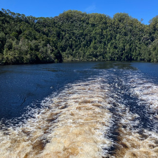
The following day I did the World Heritage Cruise on the Gordon River, probably the most popular tourist activity in Strahan. As well as venturing out to Hells Gates (the heads into Macquarie Harbour), the cruise included guided tours of Sarah Island (the previously-mentioned former penal settlement) and a rainforest boardwalk at Heritage Landing on the Gordon River. The river, like most of the rivers on the West and Southwest part of Tasmania, was the colour of Coca-Cola (centre pic above) as a result of the tannin staining by the trees. On the return to Strahan we were also able to see an old Huon Pine sawmill in operation...and, sucker that I am, I succumbed to buying a small untreated block of Huon Pine which I will sand and oil to make a functioning cheeseboard...one day.

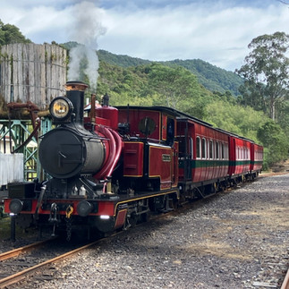


From Strahan I headed inland to NW Tasmania's largest settlement of Queenstown, which is truthfully still a small town that was once a much grander affair when it became the centre of a short-lived goldrush (two years...one major nugget!) and subsequently copper mining (which is responsible for the distinct discoloration of local rivers (as evidenced in the pic above), which will take another 100+ years to revert to a more natural colour). Following another 'Dhobey Run' (where the clothes dried with a distinctly "eau de fumée" scent due to the pervasive bush fires that had been burning in the region since my departure from Corinna), I booked a seat on the principal tourist attraction here: the West Coat Wilderness Railway. They have superbly restored three or so late 19C steam trains and run a tourist/passenger service as far as Regatta Point (Strahan) some 35km away. The trip I took, however, was the Rinadeena Climb, where these unique trains had been fitted with a very clever german-designed rack and pinion centre track rail system (centre pic above) that enable them to climb/descend a 1:16 gradient (which may not seem much, but 'normal' trains are more used to managing inclines of 1:400 to 1:2000!).


The trip from Queenstown to Derwent Bridge was, like so many of the roads I have thus far experienced in Tasmania, full of steep twists, turns and unusual cambers made even more interesting with some sizeable road deformations. To top it off, the bushfire smoke had significantly reduced visibility in places to the extent that the headlights automatically came on. Fortunately the worst of the smoke had dissipated by the time I parked up at the free camp beside the sole hotel in the area (that had only just re-opened the previous week after several months closure)....so I felt obligated to sample the beer...and a meal! The next day I visited "The Wall in the Wilderness" art gallery. Essentially it is 2 x 50m lengths of wall panels made of 3m-high blocks of Huon Pine that have been relief-sculpted to depict Tasmanian scenes of settler life, flora and fauna (as well as many stand-alone carved artefacts). Many of the panels are still only partially completed, so you can see how the wood has been transformed by the carver/sculptor Greg Duncan over a period of twenty-odd years (so far). The result is quite remarkable, particularly (for me, anyway) the skill with which Greg is able to capture drape/folds in hats/clothing and the detail of musculature in both humans and animals. Unfortunately the exhibit does not permit photography of any kind, so you will need to check it out online (search for "wall in the wilderness/images") to get an idea.

I made a brief stop at the geographic centre of Tasmania at Bronte Lagoon and spent the next couple of nights at a campground in Wayatinah (the weekly 'Dhobey Run' again!), with a standing population of @18 people, its sole reason for existence appears to be supporting a nearby hydro scheme. Despite a decent swimming pool at the camp, it was decidedly too wet and cold for me to take the plunge.
Up to now, most of my travels on the W side of Tasmania, at least, have been characterised by smoke from the various significant bushfires in the area - to the extent that I had to abandon planned stops at many of the lookout points in this rugged part of the country because you couldn't see much because of the pervasive smoke-induced haze. It has also meant that the interior of the moho and clothes and hair have been partially cold-smoked over the past few days and nights as you still need to have the windows open for air! The roads over this way are also quite 'special' - despite a 100km/h speed limit on many of them, it has been a rarity that I have ever got close to that limit.

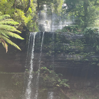


Russell Falls Horseshoe Falls Lady Barron Falls
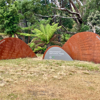
Continuing southwards, my next destination was Mount Field in National Park. It is one of Tasmania's oldest National Parks and contains a diverse range of landscapes, including tall tree forests, with plentiful waterfalls, mountains and lakes formed by glaciers. From the Visitor Centre, I undertook a 2-hour circuit (about as much as my gammy knee will take in one hit without additional support!) covering three waterfalls and a loop through some giant eucalypts and myrtles - beautiful country that reminded me a lot of NZ!

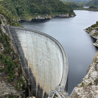


Gordon Dam Lake Pedder Bitumen Bones sculpture, Strathgordon
I then took the only sealed road in the Southwest conservation area and National Park that ended at the impressive Gordon Dam. While the photo shows a series of steps leading from the top to the bottom (on the left-hand side), and even though the infrastructure has a cable-car-type-thingy (bottom right), I didn't venture down because a). my knees would not have survived and b). the cable-car-type-thingy wasn't operating. I stayed overnight at an attractive little Free Camp known as "Ted's Beach" beside Lake Pedder, however the weather remained grey and chilly.


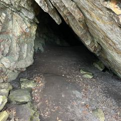
Junee Caves (photo courtesy of Chris) Me and Chris having returned from the Junee Caves walk
I doubled back along the same road the following day, stopping to check out the Junee Caves. As I parked up to follow the trail, I met a local man called Chris (born in Te Aroha, NZ!) who was there doing his daily walk from his home in nearby Maydeena (@6km return) as part of his regime to combat type 2 diabetes. He was a 'font of knowledge' on the local flora and fauna and was even able to point out trout in their 'regular' spots in the stream. Having left my phone in the moho, Chris was kind enough to take a couple of photos on my behalf - it was quite an extensive cave system that could not be fully appreciated by photo alone.
I then spent a couple of nights at a hilly low-cost campsite south of Hobart that was operated by a local scouting organisation...making use of their sole (but free) washing machine. The entire campground (made up of principally grey nomads (in caravans and motorhomes) and younger european travellers (in campervans, tents and roof-top tents) was required to to be vacated by 0900 on the day of my departure (as opposed to the 'norm' of 1000) for a period of around six hours. The reason given for this inconvenience was that there was an organised visit by a group of children, and this was the park administration's solution to avoiding any potential paedophilic incidents and being sued for failing to protect the children...what has the world come to?!!


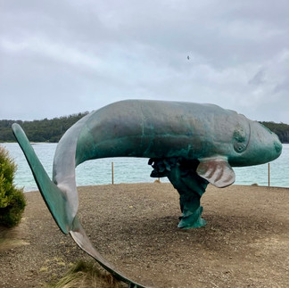


The southert-most road in Australia Southern Right Whale sculpture "Nude man, reclining on beach" driftwood
My next destination was the furthest south you could reach by road (the last 25km being dirt) in Australia, a beautiful beach area called Cockle Creek in Recherche Bay. The main road down there passed through Franklin, where there was the only Wooden Boat-building Centre in Tasmania - unfortunately it was not open for tours on the weekday that I passed through, but the riverside scenery was still very pleasant.


Franklin - wooden boats Newdegate Cave Newdegate Cave
The weather continued to not play ball, so after one night at Cockle Creek I headed back north, stopping at Hastings Caves and taking a tour of Newdegate Cave - an impressive and unique cave system in Australia, as the stalactites and stalagmites are formed from dolomite rock as opposed to the more common limestone. Included in the tour was entry to a thermal spring and platypus walk. Given that the average temperature in the underground caves was 9 deg C and the outside temperature was not especially warm, I took the opportunity for a swim in the 28 deg C thermal pool (more like a shallow swimming pool than a natural pool)...and failed to spot a living monotreme on the walk.


Huon River from the Tahune Airwalk Selfie at the swingbridge over the Huon River
Following these activities I continued to head back northwards and stopped for the night at the Tahune Airwalk, where I was also able to camp overnight for a small fee. The airwalk and swingbridge trail over the Huon and Picton rivers that afternoon were enjoyable and not too arduous. I ended up being the sole person on the entire site overnight, with the exception of being interrupted after my dinner by a muddy and stoned (ie high) kayaker who was wanting me to tow his mate's 4WD in order that he could crash-start it to then go and pick up their second vehicle which they had used to deploy their kayaks 10km upstream. Having set up my moho for the night (including deploying my telescopic ladder to mount the starlink aerial onto my roof), I was not particularly keen to pack up everything to tow their vehicle - both because the vehicle weight exceeded the limited tow bar capacity on my moho and the fact that they had no recovery gear of their own with them. I did offer to help push start the car (thankfully a manual) and the car owner (not the stoned 'dude') then started to get somewhat nasty saying that I was un-Australian (ie not a 'legit bloke'!) for not wanting to help them. I explained my reservations to him, however, he was not happy and did not think that we could crash-start his car and wanted to go straight to packing up my motorhome and then towing him. Having advised him to use 2nd gear, we pushed the car down a slight slope and (mercifully for me, I suspect) it started straight away and after throwing a few wheelspins in the carpark, the two dopeheads eventually left me in peace.


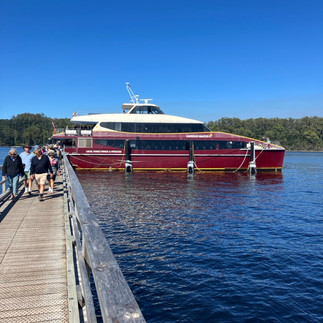
After an overnight stay in Geeveston to make use of their laundromat, I then caught the very efficient ferry service from Kettering to Bruny Island - a popular tourist destination for both beaches and local produce. The weather was once more a bit indifferent and, before trying to find a campsite for the night, I ventured to the north of the island...only to find that there was not much there other than dirt road and plenty of the associated corrugations! I ended up heading back to the southern part of the island, crossing a very narrow isthmus known as The Neck. I managed to snaffle a campsite by the beach before the crowds came searching for the same thing later that afternoon, although it was too cold for a swim. Following an overnight camp on Bruny Island's most southerly vehicle-accessible beach the next night, I stopped for a couple of days at Adventure Bay.


From here I did the Bruny Island Wilderness Cruise, which (despite a reasonbaly sunny and warm day) still necessitated the wearing of a beanie and a warm jacket to combat the chill factor associated with tearing around at 30 knots! Apart from stopping at various sea caves, passages and tunnels, and seeing the obligatory dolphins and fur seals, the highlight for me was the freshest fish and chips I had for lunch on my return!


Having previously sampled local cheeses and craft beer on my arrival, on the way back to the ferry to the mainland, I stopped at the "Get Shucked" Oyster bar (which I had to flag on arrival because it was a Sunday and had an impossibly long queue at lunchtime). Plump, creamy and delicious...best oysters so far...and already half way through them before I remembered to take a photo! Once back on mainland Tassie, it was off to Hobart for a few of days. The closest I could get to stay near the city was the showgrounds some 9km north of downtown Hobart and the waterfront. The showgrounds had been under a rebuilding programme for almost a year, however, the cost for staying there was still the most expensive for a showground in Oz so far, despite a Caravan and Motorhome Club of Australia (CMCA) membership discount. The weather was also very windy, which stirred up great clouds of dust from all the building works and even tore the awning off a nearby caravan, which will result in some expensive repairs, no doubt.

I will start my next blog from my time in Hobart. So, until then, "hooroo" from Tassie!
Jimmo (James)
+61 400 068 257


Comments